Historic Site
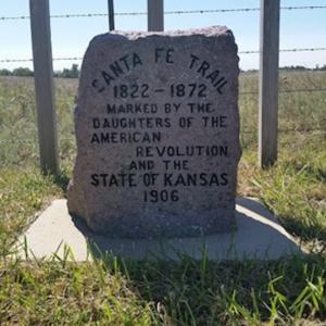
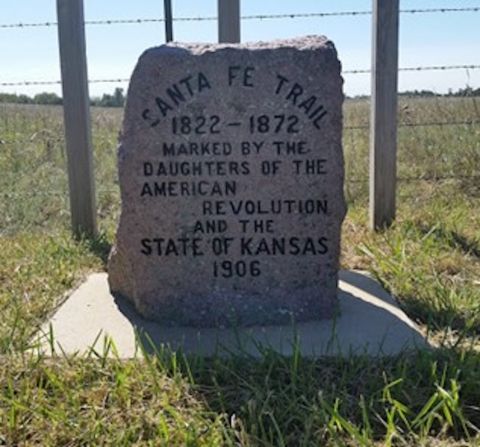
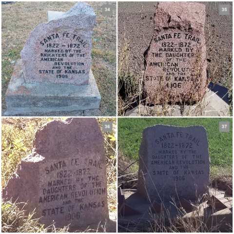
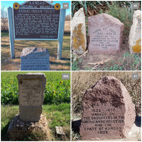
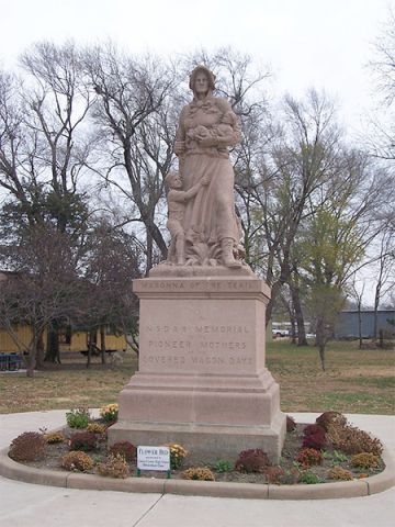
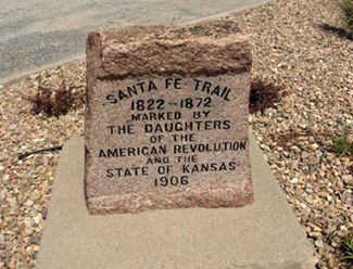
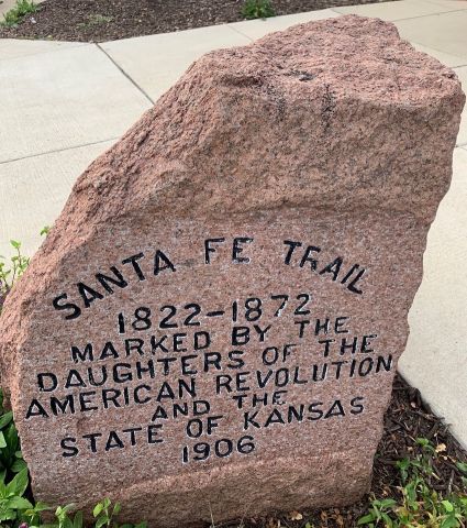
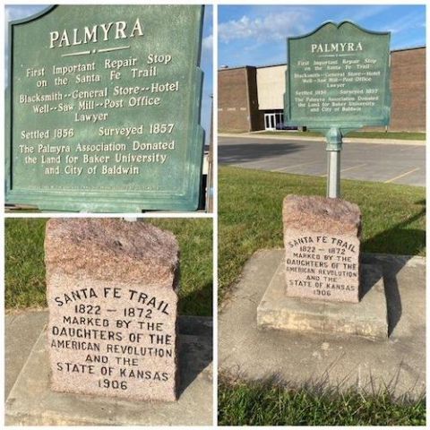
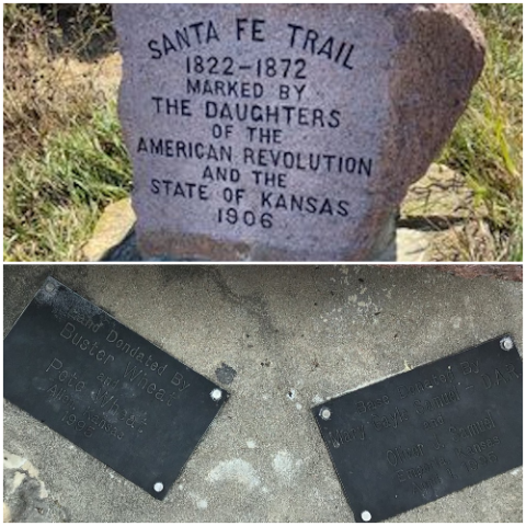
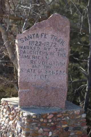
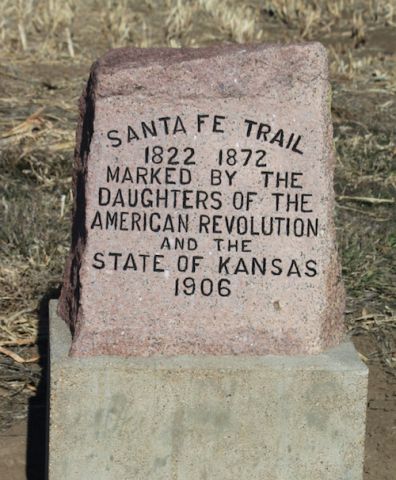
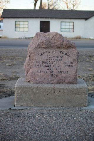
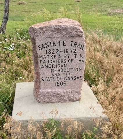
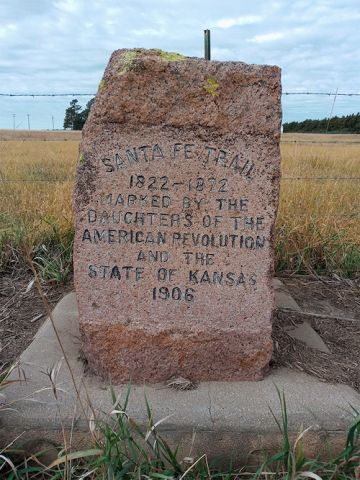
Santa Fe Trail Marker-#33 Waldeck/French Frank (8 Other Markers)
Explore Kansas
Kansas
Select a State to Explore our Historic Properties
Directions and application forms can be found on this page or in the Forms section of the DAR members' website.
[
{
"id": "context_mapping",
"url": ""
}
,
{
"id": "US-AL",
"url": "/national-society/historic-sites-and-properties/state-site-list/AL"
}
,
{
"id": "US-AK",
"url": "/national-society/historic-sites-and-properties/state-site-list/AK"
}
,
{
"id": "US-AZ",
"url": "/national-society/historic-sites-and-properties/state-site-list/AZ"
}
,
{
"id": "US-AR",
"url": "/national-society/historic-sites-and-properties/state-site-list/AR"
}
,
{
"id": "US-CA",
"url": "/national-society/historic-sites-and-properties/state-site-list/CA"
}
,
{
"id": "US-CO",
"url": "/national-society/historic-sites-and-properties/state-site-list/CO"
}
,
{
"id": "US-CT",
"url": "/national-society/historic-sites-and-properties/state-site-list/CT"
}
,
{
"id": "US-DE",
"url": "/national-society/historic-sites-and-properties/state-site-list/DE"
}
,
{
"id": "US-FL",
"url": "/national-society/historic-sites-and-properties/state-site-list/FL"
}
,
{
"id": "US-GA",
"url": "/national-society/historic-sites-and-properties/state-site-list/GA"
}
,
{
"id": "US-HI",
"url": "/national-society/historic-sites-and-properties/state-site-list/HI"
}
,
{
"id": "US-ID",
"url": "/national-society/historic-sites-and-properties/state-site-list/ID"
}
,
{
"id": "US-IL",
"url": "/national-society/historic-sites-and-properties/state-site-list/IL"
}
,
{
"id": "US-IN",
"url": "/national-society/historic-sites-and-properties/state-site-list/IN"
}
,
{
"id": "US-IA",
"url": "/national-society/historic-sites-and-properties/state-site-list/IA"
}
,
{
"id": "US-KS",
"url": "/national-society/historic-sites-and-properties/state-site-list/KS"
}
,
{
"id": "US-KY",
"url": "/national-society/historic-sites-and-properties/state-site-list/KY"
}
,
{
"id": "US-LA",
"url": "/national-society/historic-sites-and-properties/state-site-list/LA"
}
,
{
"id": "US-ME",
"url": "/national-society/historic-sites-and-properties/state-site-list/ME"
}
,
{
"id": "US-MD",
"url": "/national-society/historic-sites-and-properties/state-site-list/MD"
}
,
{
"id": "US-MA",
"url": "/national-society/historic-sites-and-properties/state-site-list/MA"
}
,
{
"id": "US-MI",
"url": "/national-society/historic-sites-and-properties/state-site-list/MI"
}
,
{
"id": "US-MN",
"url": "/national-society/historic-sites-and-properties/state-site-list/MN"
}
,
{
"id": "US-MS",
"url": "/national-society/historic-sites-and-properties/state-site-list/MS"
}
,
{
"id": "US-MO",
"url": "/national-society/historic-sites-and-properties/state-site-list/MO"
}
,
{
"id": "US-MT",
"url": "/national-society/historic-sites-and-properties/state-site-list/MT"
}
,
{
"id": "US-NE",
"url": "/national-society/historic-sites-and-properties/state-site-list/NE"
}
,
{
"id": "US-NV",
"url": "/national-society/historic-sites-and-properties/state-site-list/NV"
}
,
{
"id": "US-NH",
"url": "/national-society/historic-sites-and-properties/state-site-list/NH"
}
,
{
"id": "US-NJ",
"url": "/national-society/historic-sites-and-properties/state-site-list/NJ"
}
,
{
"id": "US-NM",
"url": "/national-society/historic-sites-and-properties/state-site-list/NM"
}
,
{
"id": "US-NY",
"url": "/national-society/historic-sites-and-properties/state-site-list/NY"
}
,
{
"id": "US-NC",
"url": "/national-society/historic-sites-and-properties/state-site-list/NC"
}
,
{
"id": "US-ND",
"url": "/national-society/historic-sites-and-properties/state-site-list/ND"
}
,
{
"id": "US-OH",
"url": "/national-society/historic-sites-and-properties/state-site-list/OH"
}
,
{
"id": "US-OK",
"url": "/national-society/historic-sites-and-properties/state-site-list/OK"
}
,
{
"id": "US-OR",
"url": "/national-society/historic-sites-and-properties/state-site-list/OR"
}
,
{
"id": "US-PA",
"url": "/national-society/historic-sites-and-properties/state-site-list/PA"
}
,
{
"id": "US-RI",
"url": "/national-society/historic-sites-and-properties/state-site-list/RI"
}
,
{
"id": "US-SC",
"url": "/national-society/historic-sites-and-properties/state-site-list/SC"
}
,
{
"id": "US-SD",
"url": "/national-society/historic-sites-and-properties/state-site-list/SD"
}
,
{
"id": "US-TN",
"url": "/national-society/historic-sites-and-properties/state-site-list/TN"
}
,
{
"id": "US-TX",
"url": "/national-society/historic-sites-and-properties/state-site-list/TX"
}
,
{
"id": "US-UT",
"url": "/national-society/historic-sites-and-properties/state-site-list/UT"
}
,
{
"id": "US-VT",
"url": "/national-society/historic-sites-and-properties/state-site-list/VT"
}
,
{
"id": "US-VA",
"url": "/national-society/historic-sites-and-properties/state-site-list/VA"
}
,
{
"id": "US-WA",
"url": "/national-society/historic-sites-and-properties/state-site-list/WA"
}
,
{
"id": "US-WV",
"url": "/national-society/historic-sites-and-properties/state-site-list/WV"
}
,
{
"id": "US-WI",
"url": "/national-society/historic-sites-and-properties/state-site-list/WI"
}
,
{
"id": "US-WY",
"url": "/national-society/historic-sites-and-properties/state-site-list/WY"
}
]