
Location:
Lyon County
145 Mile Creek Crossing
Allen, Kansas (2 miles south of marker)
GPS Coordinates:
Latitude: 38.6823
Longitude: -96.1549
Historical Significance:
After Mexico gained its independence from Spain, the Santa Fe Trail, established in 1821, became a vital commercial route to the western territories of the United States. This trail began in Missouri and passed through Kansas, Oklahoma, and Colorado terminating in Santa Fe, New Mexico. The trail was used by traders and settlers and was instrumental in opening these states for settlement. In 1846 during the Mexican American War, it was the route used by the military to invade Mexico. It became a well-established supply route for the military to their western outposts.
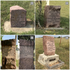
The Old Allen Town (22) marker is one of 89 red granite Santa Fe Trail markers placed by Kansas DAR between 1906 and 1914, surveyed in 2007, and restored by 2010 with funding provided by Kansas DAR chapters. This stone was mounted onto a cement and stone base. Landowners Buster Wheat and Pete Wheat furnished the land and those providing the materials, plaques and labor for the base are listed in the two plaques. Marker 22 plaques on the base read:
"Land donated by Buster Wheat and Pete Wheat, Allen, Kansas 1995"
"Base donated by Mary Gay Samuel – D.A.R. and Oliver J. Samuel, Emporia Kansas, April 1, 1995”
Listed below are additional Santa Fe Trail markers to the west.
In commemoration of the 200th Anniversary of the Santa Fe Trail, Kansas Daughters added the markers to the NSDAR Historic Sites and Properties database. More than half of the 800-mile trail passes through Kansas. Marker 25 is the Council Oak Treaty Site where a treaty was signed with the Osage Tribe to allow the right of way for travel and trade to Santa Fe, Mexico. Signing took place on 10 Aug 1825. This led to the development of trade and commerce along the trail. Marker 26 is the Trail Crossing located one mile east of a marker showing travelers a place to drive across the wagon ruts. A geocache can be found at this location.
-
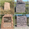
Additional 8 markers to the west (see additional images):
- (23) Agnes City Cemetery – 38 39’ 1.8” N 96 13’ 33.239” W
- (24) Rock Creek – US 56 to 200 Road, north .2 mile on the east side of the road
- (25) Council Oak Treaty site – 39° 30' 17.748" N 96° 03' 24.696" W
- (26) Trail Crossing – 38° 37' 22.799" N 96° 34' 36.48" W
- (27) Wilsey Railway Station – 38° 37' 22.799" N 96° 40' 54.12" W
- (30) Lost Springs – 38° 45' 31.223" N 96° 55' 47.006" W
- (31) Lost Springs Park –38° 34' 03" N 96° 57' 57.24" W
- (32) Cottonwood Crossing – 38 42’ 48.688” N 96 05’ 39.233” W
Historical Designations:
- National: National Register of Historic Places
- State/County: State Historical Commission
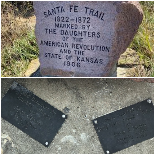
Historical Marker:
- Marker Date: 1906
- State of Marker Organization: Kansas
- Marker Organization: Daughters of the American Revolution and the State of Kansas
- Marker Text:
SANTA FE TRAIL
1822-1872
MARKED BY THE
DAUGHTERS OF THE
AMERICAN REVOLUTION
AND THE
STATE OF KANSAS
1906
Funding:
Between 1906 and 1914, Kansas DAR erected 89 Official Santa Fe Trail markers, made of red granite, at a cost of $16 each. KSDAR surveyed those 89 markers in 2007 and determined 95% needed restoration. So they were awarded a Challenge Cost Share grant from the National Park Service and contracted with stone conservators, Suhor Industries to do the restoration at an average cost of $300 per stone. Kansas chapters “adopted” a stone or two each to pay for the cost.
Physical Condition:
- Property: Preserve
Tourism:
- Open to the Public - Yes
- Family Friendly - Yes
- Admission Fees - None
- Lodging - No
Promotional Materials Available:
- Website: santafetrailresearch.com
Acknowledgement:
As all 89 markers were surveyed, beginning in 2007, and restored by 2010. DAR chapters are being asked to notify the Kansas State Historic Preservation Committee chair if they are aware of any repairs needed.
Other Images