
Location:
Grant County
Ulysses, KS
GPS Coordinates:
Latitude: 37° 33' 43.664" N
Longitude: 107° 4' 52.910" W
Historical Significance:
After Mexico gained its independence from Spain, the Santa Fe Trail, established in 1821, became a vital commercial route to the western territories of the United States. This trail began in Missouri and passed through Kansas, Oklahoma, and Colorado terminating in Santa Fe, New Mexico. The trail was used by traders and settlers and was instrumental in opening these states for settlement. In 1846 during the Mexican American War, it was the route used by the military to invade Mexico. It became a well-established supply route for the military to their western outposts.
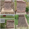
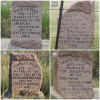
Conductor (88) marker is one of 89 red granite Santa Fe Trail markers placed by Kansas DAR between 1906 and 1914, surveyed in 2007, and restored by 2010 with funding provided by Kansas DAR chapters. Conductor and the group of markers listed below are on the Dry Route, the southwestern part of the trail heading towards Oklahoma. Water was not easily available along this route, but it was a shorter distance to Santa Fe. Wagon Bed Spring was an important watering hole along this route. Cimarron National Grasslands is a park and nature preserve in this area of Kansas.
In commemoration of the 200th Anniversary of the Santa Fe Trail, Kansas Daughters added the markers to the NSDAR Historic Sites and Properties database. More than half of the 800-mile trail passes through Kansas. Many local history sites can be found along the trail as more than half the length of the trail lies in Kansas, passing through 21 of the 105 counties. A helpful link to the markers, county by county, is: https://www.santafetrailresearch.com/research/dar-marker-location-ks.ht….
- Additional markers to the west:
- (89) Ryus – 37° 32' 0.269" N 101° 14' 40.783" W
- (90) Hickok – 37° 33' 43.653" N 101° 4' 52.918" W
- (91) Wagon Bed Spring – 37° 24' 9.407" N 101° 22' 13.681" W
- (92) Zeiler Crossing – From Marker (91) return to Rd 23, head W 5 mi to Rd E, S 2 mi to Rd 25,
- (Grant Co), or Rd DD (Stevens Co), W .6 mi to Rd 6N, S 2 mi to Rd BB, W 1 mile to Rd 5N,
- S 2 mi to Rd Z, E .2 mile on the south side.
- (93) Richfield – From Marker (92) continue west on Rd Z to Rd 1 in Steven Co, Rd 28 in Morton Co, S 4 mi to V Rd, northwest corner of V and 28 Rd (94a) Wilburton – 37° 13' 38.099" N 101° 46' 0.779" W (94) Rolla – 37° 14' 41.157" N 101° 39' 53.078" W
- (95) Point of Rocks – 37° 6' 13.507" N 101° 56' 18.851" W
Historical Designations:
- National: National Register of Historic Places
- State/County: State Historical Commission
Historical Marker:
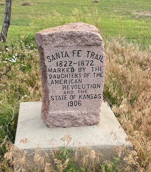
- Marker Date: 1906
- State of Marker Organization: Kansas
- Marker Organization: Daughters of the American Revolution and the State of Kansas
- Marker Text:
SANTA FE TRAIL
1822-1872
MARKED BY THE
DAUGHTERS OF THE
AMERICAN REVOLUTION
AND THE
STATE OF KANSAS
1906
Funding:
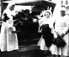
Between 1906 and 1914, Kansas DAR erected 89 Official Santa Fe Trail markers, made of red granite, at a cost of $16 each. KSDAR surveyed those 89 markers in 2007 and determined 95% needed restoration. So they were awarded a Challenge Cost Share grant from the National Park Service and contracted with stone conservators, Suhor Industries to do the restoration at an average cost of $300 per stone. Kansas chapters “adopted” a stone or two each to pay for the cost.
Physical Condition:
- Property: Preserve
Tourism:
- Open to the Public - Yes
- Family Friendly - Yes
- Lodging - No
Promotional Materials Available:
- Website: santafetrailresearch.com
Acknowledgement:
As all 89 markers were surveyed, beginning in 2007, and restored by 2010. DAR chapters are being asked to notify the Kansas State Historic Preservation Committee chair if they are aware of any repairs needed.
Other Images